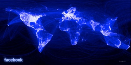
Paul Butler, Facebook intern, made a map by connecting the dots between friends on the network. He started with a sample of 10 million friend pairs, correlated them with their current cities and then mapped that data using the longitude and latitude of each city.

No comments:
Post a Comment